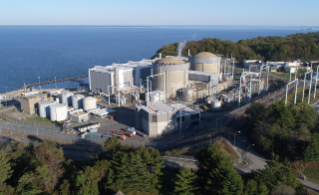
The Nuclear Regulatory Commission requires specific plans for protecting the public within an approximate 10-mile radius of any nuclear power plant. Know your location on the map and mark it. Some primary evacuation routes are listed below. In an emergency, follow the directions given on the radio, even if different from those shown below. Broadcasted directions will be based on actual road and weather conditions and wind direction — helping to ensure your safety as you leave the evacuation area.
Download Evacuation Map
Evacuation Routes
Champaign
Decatur
- IL 48 south
- U.S. 51 south
Normal
Keep listening to your radio or TV for the latest information and instructions. Remain calm. Do not rush.
Information for Farmers
When advised to do so, remove all livestock from pasture, shelter if possible, and provide them with stored feed and protected water. The county U.S. Department of Agriculture representative will provide further instructions regarding the protection of livestock and foodstuffs.
If You Have Livestock
When advised to do so, remove all livestock from pasture, shelter if possible and provide them with stored feed and protected water. If shelter-in-place and/or evacuation is recommended, efforts to care for livestock should be discontinued in the affected areas and the shelter-in-place and/or evacuation recommendation should be followed.
School Information
If your child’s school is in session at the time evacuation is recommended, children attending schools located within the Emergency Planning Zone will be transported to designated host schools outside the area. They will remain under supervision until picked up by parents or guardians. These host schools have been planned to coincide with main evacuation routes. Children whose homes are inside the Emergency Planning Zone, but who attend school outside the emergency planning zone, will not be sent home if an evacuation is recommended. They will either remain at the school or be transported to a host school or a mass care facility and be under supervision until picked up by parents or guardians. Contact school officials for more information.
Non-Public School and Day Care Information
Parents and guardians with children attending non-public schools or day care facilities within the Emergency Planning Zone should become familiar with the facilities’ emergency plans. Contact the facility operator for more information.
EMERGENCY ALERT SYSTEM / SIRENS
The Emergency Alert System will provide you with official information in case of tornadoes, floods, nuclear plant accidents or other emergencies. Turn on your radio or TV for official information and instructions.
Emergency Alert Radio Stations:
- FM 95.9, WEZC
- FM 101.5, WBNQ
- FM 104.1, WBWN
- AM 1230, WJBC
- AM 1520, WHOW
- FM 93.7, WJBC
- FM 92.3, WHOW
Warning Sirens
Communities across the United States may use outdoor warning sirens for many purposes. Sirens are not exclusive to nuclear power facilities. Sirens may be used to warn the public of many hazards, including fires, flooding, and other events that warrant public notifications. If you hear a siren, you should tune to one of the Emergency Alert System (EAS) stations listed in this site for official information. The sirens generate a loud, continuous pitch for at least three minutes. In Illinois, sirens are tested on the first Tuesday of each month at 10:00 a.m.
Emergency Broadcasts
Authorities relay emergency information and instructions to the public over local radio and TV stations, including the radio stations listed in this brochure. In an emergency, these stations are your best source of accurate news.
IPAWS
The Integrated Public Alert & Warning System (IPAWS) is FEMA's national system for local alerting that provides authenticated emergency and life-saving information to the public through mobile phones using Wireless Emergency Alerts, to radio and television via the Emergency Alert System, and on the National Oceanic and Atmospheric Administration's Weather Radio. Learn more from Integrated Public Alert & Warning System | FEMA.gov.
EMERGENCY CONTACT INFORMATION
Illinois Emergency Management Agency
2200 S. Dirksen Parkway
Springfield, Illinois 62703
(217) 782-7860
www.illinois.gov/ready
DeWitt County/Clinton Emergency Management Agency
201 West Washington Street
Clinton, IL 61727-0439
(217) 935-7790
www.dewittcountyill.com
Macon County Emergency Management Agency
282 East Macon Street
Decatur, IL 62523
(217) 424 - 1327
www.maconcountyema.org
McLean County Emergency Management Agency
104 West Front Street
Bloomington, IL 61702-2400
(309) 888-5020
www.mcleancountyil.gov
Piatt County Emergency Management Agency
1115 N. State Street, Suite 13B
Monticello, IL 61856-1672
(217) 762-9482
Information Line: (217) 762-3305
BROCHURE
Nuclear power plant licensees, including Constellation, are required by the federal government to provide emergency planning information to the public annually.
Constellation provides emergency planning information to the public by mailing postcards to all homes and businesses within the 10-mile Emergency Planning Zone surrounding each nuclear plant. The postcard has this website address along with a number to request a printed brochure.
This website is designed to provide emergency planning information in an interactive electronic format compatible with your smart phone or personal computer.
A PDF copy of the public information brochure can be downloaded below. It is recommended that you download an electronic copy of the brochure and save it to your phone or computer for reference in the event of an Internet outage during an emergency. You may also print a copy for your reference. If you do not have a printer, please call Constellation at (630) 657-4220 for a printed brochure.
Download Brochure

Dec 17, 2024

Dec 12, 2024

Dec 03, 2024

Nov 19, 2024
